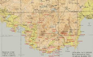
FACTORS THAT DETERMINE THE CONTENT OF TOPOGRAPHICAL MAPS.
1. Purpose of the map, depends on the aim of the cartographer usually maps are selective and hence map reflect its purpose.
2.scale of the map, large scale imply small amount of content while small map imply large amount of content.
3. date of compilation, map drawn in different period they are likely to differ in terms of content.
4. nature of the land represented, maps of different places are likely to differ in terms of content.
5. nationality of the cartographer, map produced by the foreigner and indigenous are likely to be differ due to the familiarity.
IMPORTANCE OF TOPOGRAPHICAL MAPS
1. show direction to travelers.
2. maps shows boundaries of different countries.
3. they provide information on the nature and distribution of geographical phenomena.
4. they provide background information of different areas.
5. they provide basis for the study of geographical problems.
LIMITATIONS OF TOPOGRAPHICAL MAPS
1. need knowledge on preparation.
2. maps are selective.
3. maps are very expensive.
4. some maps provide outdated information
ASPECTS OF MAPS.
Maps have got three main three aspects which are;
1. map reading, refers to the recognition of natural and man made features and their interrelationship on map by using convectional symbols and signs from the key.
or,
it is the process of examining the given topographical map to identify the geographical information represented by symbols and signs.
2.map interpretation, this concern not only recognition of features on maps but also assessing their significance.
or,
is the process of examining the given map to identify the geographical information on an area represented including climate, drainage, relief, economic activities, e.t.c.
3.map analysis, include both map reading and interpretation and proceed to evaluate the interrelationship of features represented on maps, their relationship and assessment.
MAP PROJECTION.
tutaendelea tarehe 3/04/2016........................

thnx
ReplyDeletePerfect one
ReplyDeleteExcellent
ReplyDeleteWonderful
ReplyDeleteLike it😘😘
ReplyDeleteGood
DeleteThanks
DeleteThanx
ReplyDeleteGood lesson
ReplyDeleteThanks but I want factors for geographical representation of the map
ReplyDeletethanks a lot
ReplyDelete👍
ReplyDeleteThax
ReplyDeleteThanks for the important concept
ReplyDeleteThens
ReplyDelete