MAP READING AND INTERPRETATION


According to the syllabus of 2010, the topic is referred as TOPOGRAPHICAL MAP INTERPRETATION.
it has called so because it only involve interpreting maps which show only natural and man made features.
1. MEANING OF MAP.
MAP, refers to the scaled diagram. this means that the thing that separate maps and other diagrams is the scale so other diagrams are not having a scale but for a map to be a map it must have a scale and scale is the relationship between map distance and ground distance for example 1cm on map represent 1km on the ground and we normally use scale because the size of the area to be drawn is large comparing to a piece of paper we use to draw a map.
or sometimes map can be defined as.
a representation of a part or whole earth drawn to scale on a flat sheet. examples of flat sheets are piece of paper, peace of cloth and sometimes on walls.
2.TYPES OF MAPS.
basically there are two types of maps which are;
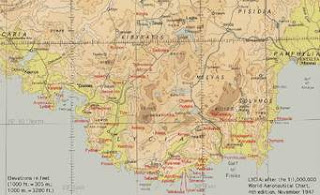
a) topographical maps, where by these are maps which used to represent both natural and man mad features. examples of natural features are mountains, hills, plateaus and water bodies such as rivers, lakes and oceans and examples of man made features are like buildings, roads and rail ways.
EXAMPLE OF TOPOGRAPHICAL MAP
b)statistical maps, these are maps that shows the distribution of the certain phenomena example rainfall, temperature and population.
EXAMPLE OF STATISTICAL MAPS
As i have said earlier that our main concern is on topographical maps so we are going to deal with this one topographical maps.
3.CONTENT OF TOPOGRAPHICAL MAP
any kind of topographical map must show three kind of contents which are;
a) natural content, which involve natural features such as mountains, plateaus, rivers, oceans, lakes and hills.
b) artificial/cultural contents, which involve man made features such as, houses, rail ways, roads e.t.c.
c) supportive content, these are marginal information given to assist the map reader of the ma. supportive content includes title, scale, north direction, key and date of compilation.
4.FACTORS THAT DETERMINE THE CONTENT OF TOPOGRAPHICAL MAPS.
tutaendelea tarehe 02/04/2016.....................

Saf sana kk.
ReplyDeleteSaf sana kk.
ReplyDeleteThanks
ReplyDeleteThis comment has been removed by the author.
ReplyDelete